Unlocking the Secrets of the Deep
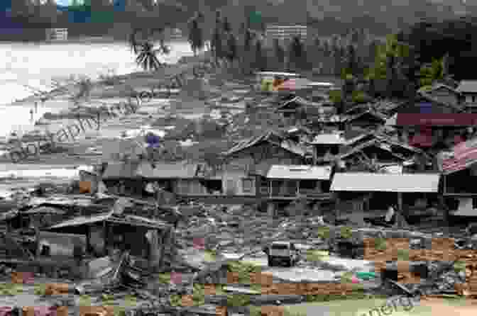
The geological record of tsunamis and extreme waves offers a unique window into the past, allowing scientists to reconstruct the characteristics and impacts of these events long after they have occurred. By studying sedimentary deposits, landforms, and other geological features, researchers can determine the timing, extent, and intensity of past tsunami events.
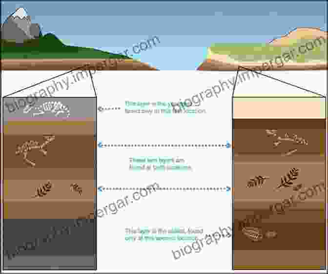
One of the most common geological indicators of a tsunami is the presence of tsunami deposits. These deposits consist of sediments that have been transported and deposited by the powerful currents associated with tsunami waves. Tsunami deposits can be found in a variety of settings, including beaches, coastal plains, and estuaries. They typically consist of sand, gravel, or boulders that have been transported inland from the shoreline.
In addition to tsunami deposits, other geological features can also provide evidence of past tsunami events. These features include:
- Landforms: Tsunamis can create or modify landforms, such as beach ridges, overwash fans, and sand dunes.
- Erosion: Tsunamis can cause extensive erosion of coastal landscapes, including cliffs, beaches, and barrier islands.
- Inundation deposits: Tsunamis can leave behind deposits of sediment and debris that indicate the extent of inundation.
- Biological indicators: Tsunamis can cause damage to marine and terrestrial ecosystems, leaving behind evidence in the form of damaged or displaced organisms.
Extending Our Understanding Beyond Historical Records
The geological record extends our understanding of tsunamis and extreme waves far beyond the limited span of historical records. By studying geological deposits, scientists can identify events that occurred thousands or even millions of years ago. This information is essential for assessing the long-term hazard potential of coastal areas and developing effective mitigation strategies.
The geological record has also revealed that tsunamis and extreme waves are not isolated events. In fact, they have occurred throughout Earth's history, and their frequency and intensity have varied over time. This information helps scientists understand the natural variability of these events and better predict their future occurrence.
Applications for Hazard Assessment and Coastal Management
The geological record of tsunamis and extreme waves has a wide range of applications for hazard assessment and coastal management. By understanding the frequency, magnitude, and impact of past events, scientists can better predict the likelihood and consequences of future events. This information can be used to develop building codes, land use plans, and evacuation strategies that will help to mitigate the effects of tsunamis and extreme waves.
In addition, the geological record can help to identify areas that are at high risk for tsunamis and extreme waves. This information can be used to prioritize coastal protection measures and ensure that communities are prepared for future events.
: Embracing the Past to Prepare for the Future
"Geological Records of Tsunamis and Other Extreme Waves" is a groundbreaking work that provides a comprehensive overview of the geological evidence for these powerful events. This book is an essential resource for anyone interested in understanding the history, hazards, and mitigation of tsunamis and extreme waves. By embracing the lessons of the past, we can better prepare for the challenges of the future and ensure the safety of coastal communities worldwide.


